Oxley Wild Rivers Tour – Day 4

We left Walcha early on the last day and headed south on Brackendale Road meeting Mummel Rd where we had been on Day 2. East again past New Country Swamp Camping Area to Gingers Creek on the Oxley Highway.


Click to enlarge
Then Stockyard Creek Rd shortcut to Knodingbul Rd and the Blue Knob Lookout. The lookout and our visit to Potoroo Falls in Tapin Tops NP were highlights of the day.
Late lunch in Gloucester and an offroad detour back thru Monkerai and Glen Martin took us home.
Icon

Oxley Wild Rivers GPX 3.80 MB 23 downloads

8 tracks over 4 days through the Oxley Wild Rivers including an extra leg near Nundle Ride...

Oxley Wild Rivers Tour – Day 3

From Bellbrook we followed the Kempsey Rd along the Macleay River past Georges Junction Camping Ground. Then up Georges Creek to Styx River Forest Road. The rain started to pelt down so we called it quits before Point Lookout. there’d be nothing to see anyway, and headed straight for Armidale for lunch.

Click to enlarge
Video

There’s a little shortcut at Dangarsleigh joining Elliots Rd with Gostwyck War Services Road. It’s obviously a cattle run with a few gates and a creek crossing in the middle. You come out on Gostwyck Rd just east of Gostwyck Chapel.

Icon

Oxley Wild Rivers GPX 3.80 MB 23 downloads

8 tracks over 4 days through the Oxley Wild Rivers including an extra leg near Nundle Ride...
Click to enlarge

Oxley Wild Rivers Tour – Day 2

Day 2 started with a fast run back through Hanging Rock and then Nundle State Forests. There were some nice sections through Wild Cattle Creek Road going south parallel and west of Nowendoc Road. The Mummel Gulf National Park road was also ‘Commodore’ standard.

Click to enlarge
After lunch at Gingers Creek there was  followed by some usually technical stuff along Spokes Mountain Trail and Coachwood Rd to Willi Willi.
Video
Click to enlarge

The ‘shortcut’ via Mackenzies Creek Rd to Bellbrook was certainly a shorter distance and all gravel. With all the gates it only saved about 4 minutes off the mostly asphalt alternative but I give it the solid vote.

Icon

Oxley Wild Rivers GPX 3.80 MB 23 downloads

8 tracks over 4 days through the Oxley Wild Rivers including an extra leg near Nundle Ride...

Oxley Wild Rivers Tour – Day 1

The first day for me took me on a detour near Bulahdelah, through Gloucester and over Barrington Tops to Moonan Flat. I camped at Polblue overnight and dropped down to Moonan Flat to meet the rest of the group for lunch.

Video

The second half of my Day 2 took us from Moonan Flat to Nundle via the most popular route past Ellerston and through Glenrock and Barry Stations.

We arrived a little ahead of time so we took an extra trip up to Woolomin through the forest.

Glenrock Station
Icon

Oxley Wild Rivers GPX 3.80 MB 23 downloads

8 tracks over 4 days through the Oxley Wild Rivers including an extra leg near Nundle Ride...

Oxley Wild Rivers Tour Overview (RR)

Oxley Wild Rivers National Park is part of the Gondwana Rainforests of Australia World Heritage Area. The park is bordered in the south at Yarrowitch and Werrikimbe National Park, in the east by Willi Willi National Park, Wittitrin and Bellbrook, in the north by the Stix River, Wollomombi River, and Gara Gorge and in the west by Dangars Gorge and Apsley Falls.

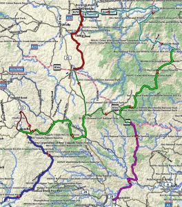
The Oxley Wild Rivers Tour did a ‘figure 8’ north from Moonan Flat via Bellbrook to Ebor and Armidale and then south via Walcha  and Gingers Creek to Gloucester.

Icon

Oxley Wild Rivers GPX 3.80 MB 23 downloads

8 tracks over 4 days through the Oxley Wild Rivers including an extra leg near Nundle Ride...